Early this year the Ministry of Primary Industries set the goal to double New Zealand export value by 2025. This would increase exports from 30 – 40% of the country’s GDP. With 71% of New Zealand’s exports coming from its primary industries (dairy, forestry, horticulture, meat & wool, and fisheries) this goal is firmly in the hands of the farmers and growers. Technology is the obvious enabler but the rural location of many primary industries places connectivity high on the agenda. Massive economic benefits have been estimated for primary industries from the installation of Ultrafast Broadband but as technology becomes increasingly mobile, the new generation of primary industries workers are untethered from the desktop and want real-time information in the paddock or forest. With the average age of NZ dairy and sheep farmers being 48 and 58 years old respectively, technology adoption is always going to be brought into question. But when you consider 44% of New Zealand farmers have smart phones compared to 45% of the entire population it appears smart device adoption is relative.
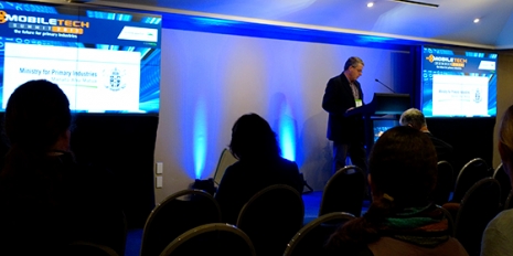
The first Mobile Technology Summit for Primary Industries was held recently in Wellington to address and showcase current and upcoming mobile innovations best suited to New Zealand’s principal food and fibre sectors.
Michael Jamieson, the MPI Director of Strategy, Science and Systems, set the scene:
New Zealand is positioned as the premium food pasture for Asia – an economy that is booming from a recent $30B wealth increase. New Zealand’s negotiation of the first Free Trade Agreement (FTA) with China set the benchmark for best-in-class market access to Asia. Red meat is increasingly becoming the choice of food for the growing Asian middle and upper classes, further increasing export demand from NZ. Compared to the US however, NZ cows are only 50% efficient for milk production although genetically capable.
Productivity is the overwhelming focus for technology in primary industries. Like any supply chain productivity equals return and in farming terms, 1% productivity equates to $4B.
Over the two days, speakers from businesses spanning software, telecommunications, hardware, analytics, and research presented products and technologies, the challenges the industry face, and predictions for the future. Here are some of revolving themes:
The NZ CEO of Alcatel-Lucent, Andrew Miller, discussed the telecommunication equipment giants’ role in connecting the rural communities to the web and, increasingly, the cloud. The rural broadband initiative (RBI) now connected 93% of rural schools and ‘Fibre to the Property’ (FTTP) offers a 25% reduction to farmers. The research and development engine inside Alcatel-Lucent, Bell Labs, released a report in 2012 outlining the benefit of broadband to New Zealand. The study estimated over $33B of economic benefit to NZ over 20 years with $9.1B benefitting the dairy sector alone through productivity increases.
Comments from the floor however highlighted that NZ farms are regularly 5km from the next property and 10km from the nearest town, so will still rely on cellular telecoms in the short to medium term. The need for ubiquitous broadband is critical.
Denis O’Shea of Mobile Mentor talked about ‘app rash’ describing the situation where maintenance and updates of mobile apps across different platforms (iOS > Android) are not consistent creating continuity issues over mobile ‘fleets’. The trend of ‘bring your own device’ (BYOD) where employees are using personal devices for work is becoming more prevalent and is encouraging adoption of technologies at the workplace. The pain-point in a BYOD eco-system is security of confidential information on personal devices but companies like Good are containerizing devices to partition and protect confidential work data from personal.
In a panel discussion, the issue of poor inter-operability of devices was raised. One farmer in the audience had over 25 different vendors of software solutions with little cross-functionality. This fragmented approach inherently limits the full capability at risk of productivity. The consumer model is to provide access to open APIs (software interfaces) for 3rd parties to connect to (e.g. adding traffic overlays to Google Maps). The call is to be less proprietary and more open to improve inter-operability.
The infamous cloud is undoubtedly the data platform of choice. Mark Pawsey of agricultural software firm SST Software predicted ‘the desktop has had its day’ but the cloud also is ‘too limiting when processing heavy data off-farm’. The SST systems use combinations of desktop and cloud services to lower the data intensity in agricultural applications. The advantage of the SaaS (software as a service) model is the software isn’t installed locally on the customer’s machine but instead accessible through the web, which means no user installation requirements, fully maintainable (and upgradable) software, and that all users are operating the same version (compatibility benefits). As previously discussed though, high speed connectivity to the web is critical.
There was an underlying theme debating whether the skill base of the users was at the right level to adopt and use the technology. One service provider described the common issue of a farmer downloading an installation package then not being able to find the file. Struggling ICT literacy rates certainly faces the industry but training services are now being fully integrated into most offerings and there are numerous training initiatives being coordinated for primary industry workers and smart devices. There was emphasis placed on the need for usability from a developer perspective.
There is massive growth and discussion around deriving useful information from data. Treemetrics called it the ‘analytics competitive advantage’ and Warren Eagle of Geo Systems correctly pointed out that ‘technology is the tool and management want the data.’ Mark Pawsey of SST software used the food analogy to describe social media data as ‘junk food’ (it has a place in society) whereas the data coming from primary industry sources is the ‘nutrition’.
Enda Keane, CEO of Irish forestry analytics company Treemetrics, Skyped in on the morning of the second day from their headquarters in Cork. This was a great talk that discussed the use of mapping and analytics to improve efficiencies in forestry. Global demand for timber is set to double by 2050 and NZ are now exporting more timber to China than Russia.
Keane’s view was if the log felling machine is in the forest, it’s too late. The analysis needs to be done as early as possible to identify and target the right trees to be cut. Treemetrics use laser scanners to accurately measure the shape, size and straightness of trees in a forest, replacing the traditional calliper measurements. Data of each scanned tree is downloaded to desktop computers where analysis software translates height, taper, straightness and other metrics into 3D simulation models. The models then determine the cut information ensuring the optimal use of the tree for the intended product: pulp, palettes or logs. The tree coordinate information is fed back into the logging machine for operator use.
Treemetrics systems are focussed on minimising what Keane calls ‘just-in-case’ forestry practises where more timber is felled than required. He describes it as the eBay for forestry where forest and sawmill owners can interact and get the best timber efficiencies.
TracMap uses Google Maps data to monitor and control space-orientated systems on land such as fertilizer spreading and irrigation. Fertiliser planes or trucks are equipped with TracMap devices to illustrate which paddocks to spread, where specifically to spread, and will trace the route to prevent over spreading. Job data can be returned to the farm manager for records or handover if the job isn’t completed.
The buzzword ‘big data’, used to describe a massive volume of data so large that traditional processing databases and software techniques are inadequate, was raised a couple of times. Big data analysis takes huge data sets from many sources and runs analysis processes to identify trends and patterns. Traditional software processing methods have a clear goal and so can be selective of what data is analysed and transferred. This focuses the processing effort and reduces transfer requirements of data (bandwidth and connectivity) – big data will place heavy requirements on this. As the industry moves towards using more and more sensors in the field (on- and in-animal, climate, soil moisture and composition, spatial, etc.) the multitudes of data increase enormously.
Big data hadn't been deployed by the companies in the room but the conversation suggested it wasn’t far away and a focus for most.
There were numerous references to unmanned aerial surveillance technologies for spatial mapping.
Rowland Harrison of ‘uninhibited aerial vehicle’ (UAV) business Hawkeye UAV discussed the use of unmanned drones for agricultural mapping. The lightweight fixed wing drones use camera technology for geo-mapping and volumetric surveying. Harrison made the point that 80% of the work is done at ground level to realise the data into highly accurate 3D data maps – accurate to 25mm in the X and Y and 100mm in the Z! The technology has been picked up by the mining industry to map opencast mines for compliance requirements.
Aerial Surveys provide geospatial mapping and aerial photography services across industries with a range of imaging technologies.
LiDAR uses sensing technology to analyse and interpret reflected light from emitted lasers. When applied to high resolution aerial photography 3D modelling of land can be developed to determine slope and contour information.
Hyperspectral imaging collects electromagnetic spectrum information from aerial surveys. Materials have different spectrum signatures making it possible to identify crop health (as healthy vegetation reflects more light), water quality, and species. A recent aerial tree survey in Hamilton correctly identified 96 of 98 tree species in a park from hyperspectral imaging.

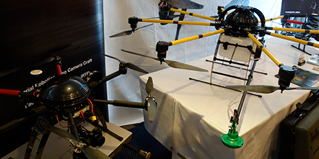
Linda Bulk of aerial robotics business Droidworxs talked about the Raglan based company’s rise. The extensive range of radio controlled craft has taken the film industry by storm by being able to carry film and photography equipment. The GPS integrated machines can fly for kilometres (providing line of sight) and will return to the start point if the signal is lost. Paths can be drawn on smart devices for the machines to follow. Droidworxs recently scooped the Most Viable Business Award at Fieldays after showing potential for their craft in the agricultural sector: the soon to be released Ag-Monster is a crop spraying aerial copter that can carry a 20Kg payload of pesticide to hard-to-reach locations on farms.
At $7k – 25k for ready to fly models the Droidworxs machines will likely be off budget for most farmers in the near future. Look out for service models popping up though providing the technology on lease to farmers.
Comments
Post new comment